Greece to Map Trails for New National Path Network

Aiming to highlight Greece’s hidden natural beauty, the Environment and Energy Ministry will develop a network of trails and hiking paths spanning routes across the country. 

Under the “Creation of a National Network of Paths and Hiking Routes” project, Greek trails will be mapped into a cohesive network, supporting the preservation and protection of the countryside as well as Greece’s natural and cultural heritage.

The Retsina Trail, Skopelos. Foto: Lisa Manly

This initiative is led by the Recovery and Resilience Fund in collaboration with the Natural Environment & Climate Change Agency (OFYPEKA).“The creation of a National Path Network will help showcase Greek nature and support local sustainable development,” the ministry said in an announcement. Following the decision by Energy Minister Thodoros Skylakakis and Deputy Economy Minister Nikos Papathanasis, 67 out of 175 submitted proposals have been approved, with a total value of 30.2 million euros.

The approved proposals, submitted by municipalities, regional authorities, and monasteries, include trail network projects in locations such as Evia, Soufli, Oinousses, Kalymnos, Tzoumerka, Asterousia Mountain, Folegandros, Naxos, Donoussa, Heraklia, Ano Koufonissi, Schinoussa, Drama, and the Geraneia Mountains. Additional networks will also be developed in the regions of Western Macedonia, Epirus and the Peloponnese.The ministry noted that other candidate organizations submitting the required supporting documents for the call for expressions of interest may qualify for review by the ministry and the OFYPEKA Committee in the second evaluation round.

(Published 31 October in the GTP https:news.gtp.gr/2024/10/31/greece-to-map-trails-for-new-national-patj-network/) You may also be interested in their follow-up article https:news.gtp.gr/2024/11/04/peloponnese-region-invests-in-hiking-tourism-with-expanded-trail-network/

There are 19 National paths and an attempt is in the pipeline to connect the mountain trails with each other although some are still only at the planning stage. Full details can be obtained from info@trailpath.gr. or further details can be obtained from me. The most popular are the Menalon Trail, the Ursa Trail, the Epirus Trail and the Nestos-Rodopi Trail.

Greece is also crossed by part of the European long distant E4 trail (Source: Hellenic Federation of Mountaineering & Climbing).

A SHORT GUIDE TO THE MONASTERIES

There are 14 monasteries on Skopelos. All are Orthodox. Five are inhabited and open to the public. They are closed between 2pm and 5pm. Four are privately owned. The others are closed, disused or ruins. Nearly all have nearby fresh water springs.

Please observe their dress code, show respect and leave a donation at least for candles lit.

Nuns should be addressed as ‘sister’ and monks as ‘brother’.

PALOUKI AREA

EVANGELISMOU TIS THEOTOKOU

Meaning: The Annunciation. The time when an angel appeared before Mary with lilies and told her she was pregnant.

Name Day: 25 March. First recorded restoration took place in 1712. Since July 2024, monk Paisios has resided there.

METAMORPHOSIS OF THE SOTIROS

Meaning: Matthew 17 – when Jesus was temporarily changed physically ‘his face bright as the sun, clothes white as light’. It was a short glimpse and proof for (doubting) Thomas that He was indeed the son of God.

Built in 1636. Name day: 6 August when grapes are offered to the congregation. Monk Dionysis has resided here for some 20 years.

SAINT BARBARA

Meaning: Barbara the martyr lived from 273-306AD. Her father kept her prisoner and is usually portrayed with chains and a tower.

The building was first restored according to records in 1697. Name day: 4 December. Nun Joanna has stayed here since 2024 before which she lived in Evangelismou.

TIMIOU PRODROMOU

Meaning: The honourable John the Baptist; saint of love, loyalty and friendship.

Built in 1616. Name day; 24 June. Monk Theothosis arrived in 2020 and has transformed the place for the better, even selling his own art in the gift shop.

TAXIARCHES, VATOS (Uninhabited)

Meaning: The arc-angels Gabriel and Michaelis in the area of Vatos (bramble).

Accessible only on foot. Name day: 8 November when many islanders make their way there.

PANAGIA LIOVATHIOTISSA (Privately owned by Virgilios Tsioulli)

Built between 16th and 17th century. Name day: a changing date soon after Easter.

EPISKOPI (Privately owned by the Dimitriadou family)

Amazing finds during it’s restoration including evidence of a Roman temple dedicated to Artemis.

Name day: 15 August

AG IOANNIS KOTRONAKI (Closed)

In good condition and a monk did briefly stay here, but it does open its doors to celebrate its name day.

STAVROS (Privately owned by Andromachi Balazoudi)

Meaning: The cross. The outbuildings are now ruins but the church is intact.

Name day: 14 September

PERA KARIA AREA

AGIA MONI KIMISI THEOTOKOU

Meaning: the domination of Mother Mary

Inhabited by sister Herovim. Name day: 15 August.

AG GEORGOS (ruins but the tiny church within its walls is intact).

Name day: it falls between Palm Sunday and the second Sunday of Easter.

AG EFSTANTHIOS (Privately owned by an organisation from Thessaloniki)

Name day: 20 September when islanders make their way to this remote area to attend the popular event

ANALYPSEOS (Privately owned by the Kosma family)

Meaning: The Ascension. Traditionally celebrated on a Thursday, the 4th day of Easter

TAXIARCHES (GLOSSA)

Restored to its former glory in 2000 with EU funding.

The full version of this article is available on request

Watch the Birdie

As the dream diminishes of getting the local authority to adopt responsibility for all the trails I have spent the last umpteen years reinstating and maintaining, I have turned my efforts towards passing on knowledge of our local flora and fauna to the general public. Experts in their field are invited to submit copy together with any images they might have and photography enthusiasts/artists approached to contribute their pictures. I put the two together, arrange for the printing and voila, a field guide book! Skopelos Trails sponsors the project, which takes about a year from beginning to end, excluding the expert’s research. The resulting book is then made available through mail order via this site and locally at various outlets. The Walking Guide book will eventually adopt the same design as our published book on insects and butterflies.

In the pipeline is a guidebook on amphibians and snakes (scheduled for next Easter) plus another on bats and birds. Others will follow in the series. My walking guide book contains a list of birds, provided by various tourists over the years but I would be delighted if I could find an expert ornithologist, prepared to provide copy. Please message me if you are interested in contributing.

SNAKES – the misunderstood

It’s that time of year again when you’re likely to encounter these reptiles of the suborder Serpentes. As it happens, I am researching with a view to writing a book on this subject. Should be published by next year.

None of them are dangerous unless provoked.  If you’re worried, buy a first aid kit from the pharmacy for 14 euros just in case. It has everything you need to stop the venom from travelling, then get to the Health Centre.

Of the Colubridae Rat Snake family we have two types on Skopelos; Leopard (Elephe situla) Spitofido and Four lined (Lafiatis). They are the largest and grow up to 2 meters. Beautifully coloured. Seldom hiss and are calm. The 4 Lined are excellent climbers and swimmers. Some tourists can vouch for the former. One recently came ashore at Panormos, made its way along the beach then went back into the sea. They eat small mammals, birds and lizards. Non venomous.

Eastern Montpellier Malpolon insignitus  ( Sapethis or Savrofido). They grow up to 2 meters. Mildly venomous rear-fanged. Variable colours (green, black, grey, green) depending upon juveniles or adults/male or female. Feeds mainly on lizards, rodents, birds, amphibians and other snakes. It will defend strongly if threatened by hissing loudly, raising its head, flattening the neck and pretending to attack. It will bite if caught. Pain, swelling and maybe fever are symptoms that may occur that usually relent in a few hours.

Large Whip Snake – possibly Hierophis jungularis (Dendrogalia) Whilst they don’t usually occur on the same island as the Four Lined snake, it is believed they are here. The common black snake. One of the longest reaching sometimes up to 300cm. Very swift. Non poisonous.

Nose-horned Viper (Oxia). It has connecting brown spots, surrounded by black. Body grey.  When disturbed they hiss loudly. Highly venomous. Image by Costas Andreou.

A Field Guide to the Insects of Skopelos

posted in: Uncategorized | 0

I’m very proud to have sponsored the migration, printing and publication of this wonderful new edition.

First published in 2015 by Doctors Brian and Elizabeth Ridout, it could easily have fallen into the memory of time as it became out of print and thus no longer available.

Brian and Elizabeth are biologists who have specialized in the conservation of heritage buildings around the world. In 2003 they came to Skopelos to visit friends. They liked it so much they subsequently bought a house in town and later (now sold) kalivi in the once beautiful Moutero and ever since visit several times a year.

It soon became apparent to them that there were no reference works available to identify the insects commonly seen on their walks in the countryside and decided to write one themselves! The task took TEN YEARS of research and was originally a basic field guide.

Text and most images by Brian Ridout, the scenic images are by Lisa Manly and the design and cover photo is by Heather Parsons. It’s available on line here and at the following local shops: Hoharoupa (next to Vodafon), the old Kiosk old port, Ideas, Juices & Books and the kiosk in Glossa by the school.

The Ridout’s wish to thank Heather for turning the new edition into a work of art as well as of science.

Who cares?

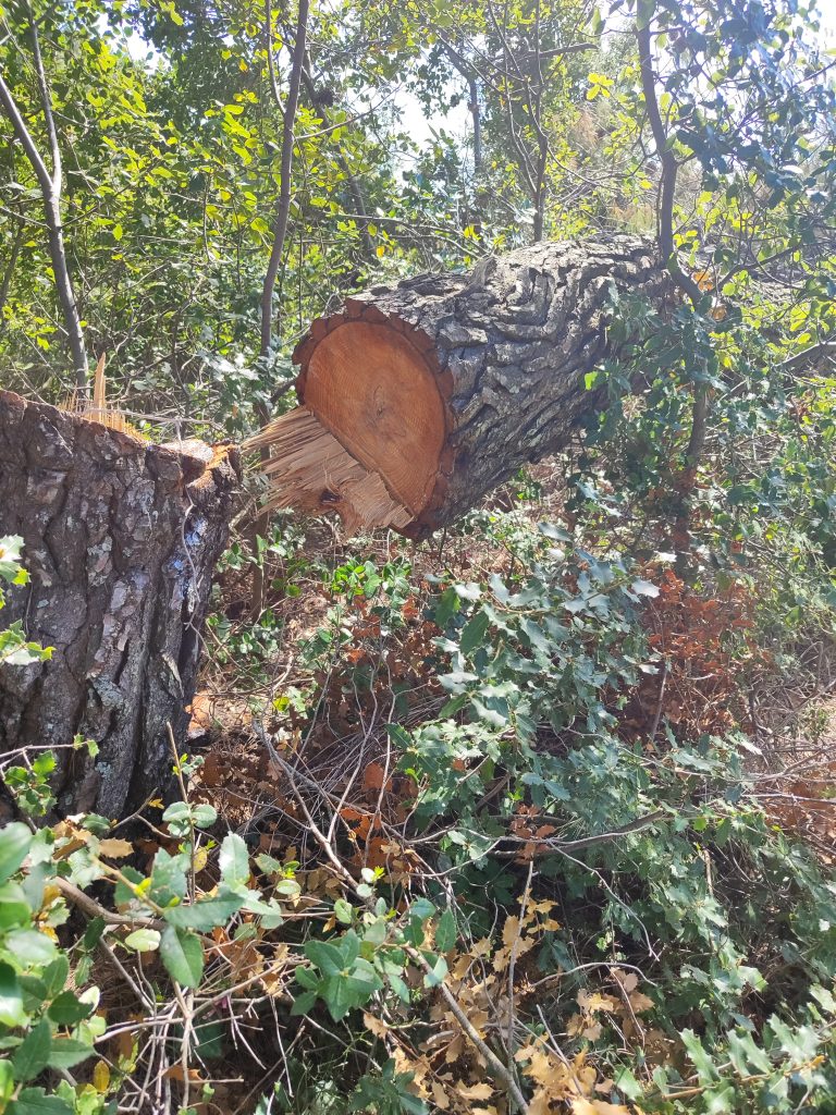
The last month’s have been spent removing cut down trees that have been abandoned thus blocking the trails. In this situation, we take pictures and GPS and send to the Forestry department. Not expecting a result I then tell them I will remove the blockage myself unless they contact me. I then get a message saying to go ahead. First all foliage is removed so we can see what we are dealing with. We remove with a chainsaw the branches facing upwards and outwards but leave the downward ones in case they are load-bearing. The owner is also contacted if possible to ascertain why the trees were cut in the first place and to inform them of the consequences of their actions. This has happened in Pera Karia, Potami, Vouno Glossa and Moutero.

Accounts for 2023

posted in: 2023, Uncategorized | 0

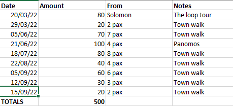
Whether you’ve made a donation or not or are just wondering how monies are spent, here is a spreadsheet of expenditures for the year 2023. The majority expense was petrol to get us to the trails to be cleared plus food for the volunteers. I conducted several hikes, boosted by two Austrian groups, which helped cover the outgoings.

Expenses

Financial Support

The T Trails

posted in: Uncategorized | 1

Some time prior to 2010, the local council obtained funding for:

  • to pave and sign seven trail heads
  • to install umpteen covered picnic areas with seating, a table and a small waste bin
  • a paved ‘platia’ in Djelili
  • the restoration of the Old Klima council office complete with air conditioning unit
  • a roof in the style of the picnic area over the Klima spring

The routes (all linear) were partially covered (some more than others) with rocks and in some places a small entrance wall erected. The trails’ surface were rendered uneven, uncomfortable and wobbly to walk on – most are downright dangerous in fact, of bad workmanship and a total waste of money as they weren’t needed in the first place.

Some walls and kiosks have fallen down and just left in a dilapidated condition, the bins are useless and in such remote areas there would never be a collection possible.

The council office doors have never opened.

The signs are not to EU standards.

The overview maps at the port were situated facing the car park and being under a roof, the area became a motorbike parking spot until recently when it became a seating area. The maps anyway became quickly faded and are now rendered useless.

The latest Terrain map doesn’t give them a mention and the poles will be removed as part of the famous Hiking Project. Pity the same can’t be said about the stones.

Try as I might, I couldn’t find out who sanctioned this white elephant of a project nor what criteria was used for choosing the routes, why the beach like stones were used when there was already a perfectly comfortable trail existing nor why a council building would be restored in, for the most part of the year, an uninhabited village.

iNaturalist

You don’t need me to tell you how many apps and publications exist that help us identify the flora around us. We all have our favorites. Ours is iNaturalist. It is based at the California Academy of Sciences and is an independent nonprofit platform. Skopelos Trails is a donor, contributor and supporter. Confirming contributions, iNaturalist is used as a reference by study groups from all over the world. They can now suggest an astounding 80,000 species of plants, animals and fungi. I log our flora even when I know what I’m looking at. I do this for our records, for the use of others as well identifying unknown species.

It is through this platform that we were contacted by Spain’s department of Biogeographical Eco Botanical facility at the university of Savile who invited us to contribute towards their project on the study of the cytinus rock rose paracite. Over a period of a month, we collected samples of the female and male flowers (inflorescences) and dried them in bags of salt before sending them off in the post. For our efforts, we received a surprise donation which was about the same amount as the donation we had already made to iNaturalist!

What is Geocaching?

posted in: Uncategorized | 1

noun: A hidden store of things for future use

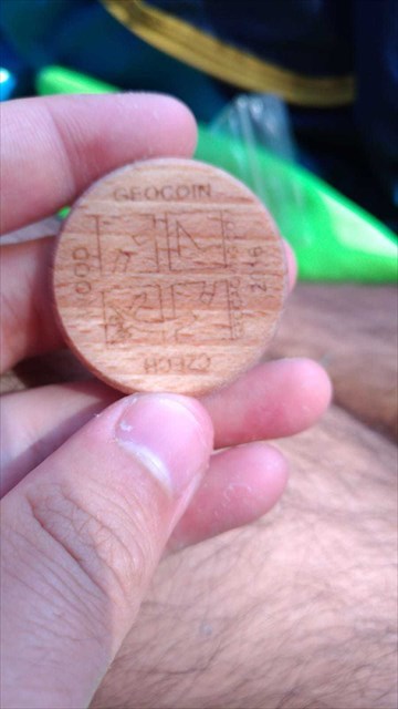
An enthusiast has his own stamp!

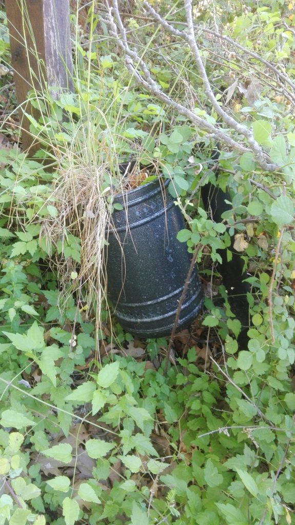
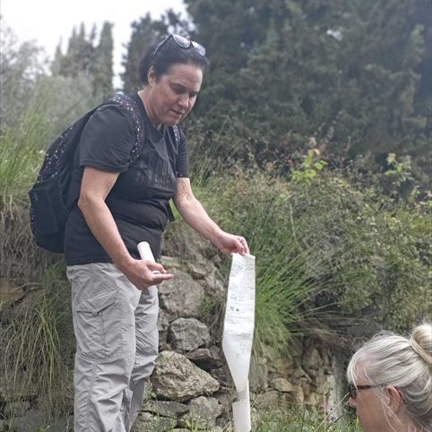
My signature cache is an empty plastic tube that previously contained soluble supplements. The lid handily contains a sealed section of silicon balls that help keep dry the scroll of paper where cachers register their find. Every cache has a unique GPS location plus a few hints. Cachers also let me know of their find by way of a message via the Geocache platform which has a downloadable app for your phone or a website if you prefer. This is where you find the GPS location map of each cache. I have placed 17 caches all over the island and plan to add more.

I’ve already had to replace many of the caches as they keep going missing in some locations. We found one on the ground near the hiding place; the lid of which had teeth marks around the rim, so I’m wondering if rats might think them eatable. I’ve started taping a rock to the tube in an effort to make them too heavy for a rodent to carry away!

Geocaching is a fun way to explore the island, taking even seasoned tourists to spots they’ve never visited before. It’s also entertaining for children and a way of getting a reluctant child to go hiking. All you need is a GPS or smartphone, a pen and a sharp eye.

Geocaching is world wide so take a look at their website, http://www.geocaching.com and see if anyone has hidden any around your next destination.