THIS AND THAT

posted in: Monthly roundup | 0

On 17 September 2024, the mayor wrote to inform me that the Ministry had approved 600,000 euros for the Trails project, submitted some 4 years previously. I was then informed that the work had been put out to tender, the result of which would be by the end of June this year. I have now learnt that the amount of 275,000 euros has been allocated for the trails project and will be finalized by the end of September. Draw your own conclusions.

The first volunteer of the autumn season arrives on Sunday. Her name is Kirsten and she’s from Germany.

I’ve been asked several times, even though it is mentioned on this website, where my books can be purchased locally. Hoharoupa stationery shop, Puesto coffee shop are open all year round and carry stocks plus Juices & Books (summer only).

For those who don’t subscribe to social media (those who do can stop reading now) I have been finding eggs placed in the same location in Myli over a period of about 2 years now. On hiking this trail recently, there was not only two more eggs but also a clove of garlic. Among the comments, Sue has suggested it may be a folklore. Such things are often peculiar to certain countries and I’ve no idea if this one is for Greece and apart from the Blue Eye and strings of garlic, I’m not aware of any other protective measures folk here take.

Updates – A Walk Down Memory Lane

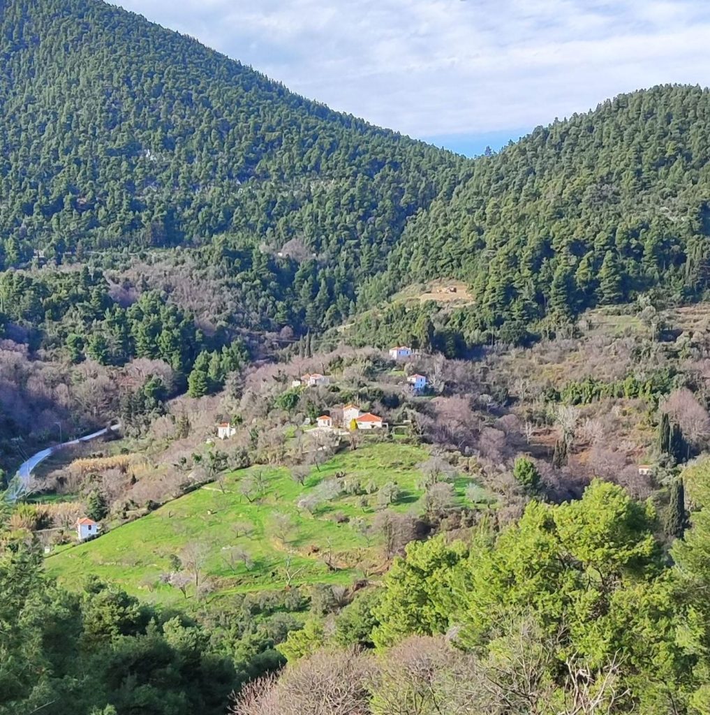
It’s been too long since I looked through the Skopelos Trails Walking Guide book in order to update it. Since the 4th Edition was published ten years ago, many changes have taken place. I’m also wondering whether to keep the additional information regarding fauna, bearing in mind we have published detailed books on the same subject (and flora at some point in the near future). What do you think?

So I have systematically read through the entire book and have the following comments:

Inner sleeve email is now skopelostrails1@gmail.com. My request about not using the book for profit or gain has fallen on deaf ears. You know who you are.  The PLEASE NOTE box can now be ignored as these routes are regularly maintained. Under Jargon, you can add: Calderimi – Old cobbled ways. The original highways. Kalivi and kalivia (plural) – stone countryside cottages used as shelter during harvest time – they’ve nearly all been renovated and many are now AirB&B.

Any reference to Nastas tchiperadiko should be ignored. It’s been closed for years now. The family brickworks kiln was dismantled too. The son of the original owner carried on this popular business though which is now called Dimitraki and can be found on the monastery road. For the moment at least, a better landmark is the ACS Courier service that is situated at the Ag Reginakis junction.

Walk 1. The Old Stafilos Road, as predicted, is now entirely asphalted (even covering bits of old calderimi) as is the road to Ag Marina spring.  After pic.3, I recommend you keep left, passing the boat yard after which you enter a beautiful area of wiggly trees called Lalaria. At the curve, turn right (ahead is a dead end) and up the slope, emerging just opposite the house in pic 4.

Walk 2. The mills are no longer visible having been consumed by foliage.

Walk 4.  Agnondas. This route will not be appearing in future editions. Better to use the Kokala/Heliport route up and drop down to Agnondas opposite the goat station.

Walk 6.  Glysteri is now an ‘organised’ beach with all that brings with it. As predicted, it is no longer ramshackle.  Image 18 of the Kastro car park is historical. These days it is always full of cars and the wording Kastro on the wall has been painted over. This place was a famous traditional music venue from a time that sadly no longer exists. Also Remetzo (up on the left of pic.19) We used to go there not only to drink tchipero but to help Rigas tread his grapes. At least the M4/M25 motorway signs referred to have been removed. However, the mayor thinks the discrete replacements are too small! I know which I prefer.

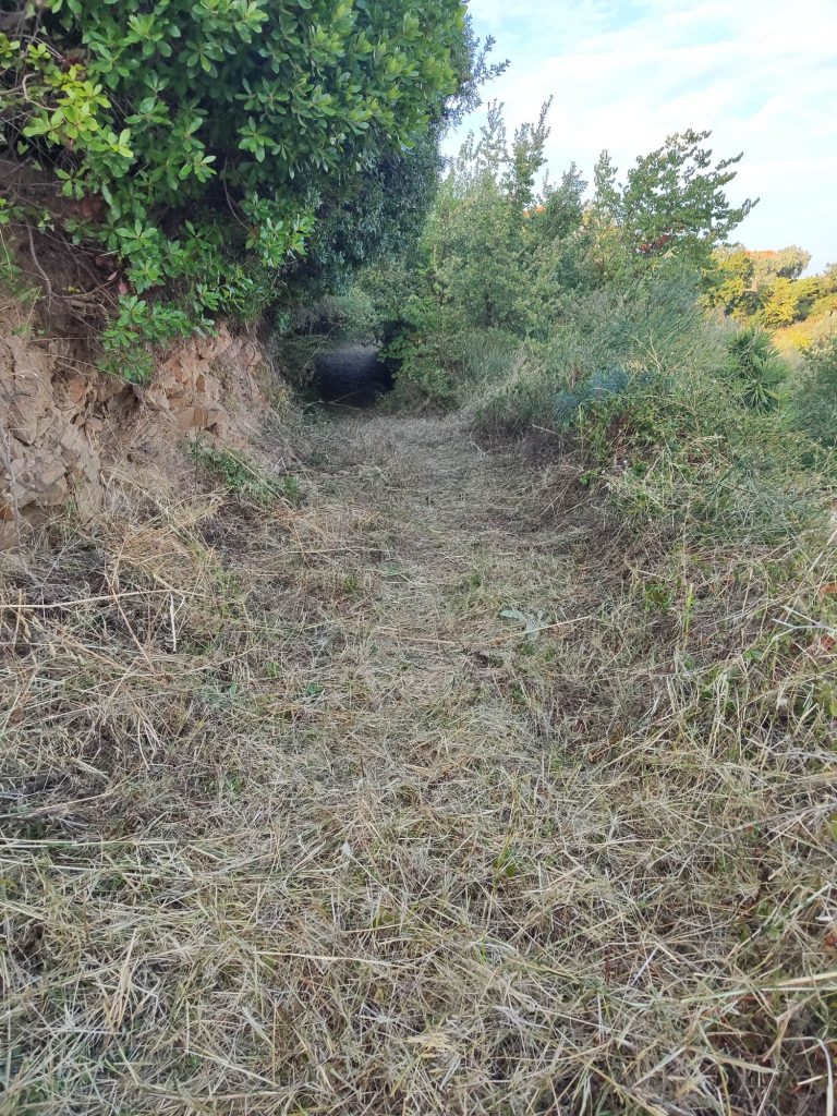
Walk 7. The covered seating area at Djelili was destroyed in a flood shortly after construction. The T Trails will be phased out eventually (see separate post on this site).

Walk 8.  The first mill referred to on this route has sadly been renovated beyond recognition and its sluice above has been filled in. The second mill house has survived though. My ginger-haired friend (pic.35) has gone grey! He still has a dog though and this one also barks.

Walk 9. Believe it or not, the pile of sand referred to (pic.43) is, ten years later, still there!

Walk 10. Tria Plantania. Stis Stathou spring was fenced the last time I was there.

Walk 11. The flat roofed house now has a tiled roof. I haven’t cleared the ‘natural’ route for years. Since the Petrovrissi spring dried up, it is no longer regularly used. The other route was bulldozed and now a few new builds have sprung up. It’s really difficult to walk down as it’s so steep. Better when it was a natural trail meandering up the mountain and roots were our stairs.

Walk 11.  Return route 3. The trail behind Vromoneri was always a favourite of mine but since the occupant of a kalivi situated beside it installed a huge dog (as well as pigs and goats) we’ve been unable to maintain it.

Walks 13-16 The Monastery area. The old Dilinia taverna building was raised to the ground and a modern structure has taken its place. For updates concerning the occupants of the monasteries, please read my previous post here.

Above Mon. Sotiros, just below the E Mana tou Nero spring, Spiro the goatherd no longer has his camp. He still looks after his goats though, day after day. Nikos, the other goatherd with whom he shared Palouki, has retired and did not pass on his herd. This is rather worrying as it means the trail to the peak will slowly grow over. Time will tell. The curve above Mon. Sotiros is called Anamniseis (Memories).  The trail just above Anamniseis corner which emerges onto the Lower Mast Road, does not continue on opposite. You have to turn right onto the LM road until the end and pick up the trail to the summit there. You can also go straight ahead where there’s a goat trail down to Ag Marina – for the moment at least. Towards Taxiarches, the terrible motorway signs have gone (pic59).  Beyond Taxiarches, it is intended to forge a trail to enable a circular route.

Walk 17.  Kimissia/Panormos. Opposite Moutero church, the pole where my sign was hung, was sawn down. The sign is now on the olive tree. The steps at the other end of this section have gone and replaced with a slope. The road through Moutero is now asphalted.  Pic108. This municipal road has been kidnapped by the owner of the villa at the end of it. He is also discouraging hikers from using this route. The situation has yet to be resolved but is ongoing. Take your chances as it’s not fenced or continue on the main road until a signed dirt road on the left, continue by the goat sheds and down to sea level. Unfortunately it’s a lot longer and not as shady.

Walk 18. At the top of Anania hill, the road has been asphalted, covering a portion of very old calderimi. What to say?  No trail was ever found after Platanakia. It must have been a track that closed shortly after the resin collectors ceased using it.

Walk 19. Sendoukia. The motorway sign has been removed (pic.74) but tree culling in the area has make the place look rather ugly. You could return to town via The Adventure Trail. Refer to the Terrain map as to its location.

Walk 22.  Old Klima’s aluminium roof is now made of wood (see my post about the T Trails). The wooden bridge on the way down to Loutraki is now made of cement. A lot of time was spent on reopening this portion of trail as it had been closed for many years and was being used as a general dumping ground.  The Avra hotel is now called Natura Luxury Boutique hotel. The old mill house beside the stream is a pizza/café called Petrino. There’s a short trail beside the steam at the end of which is a beautiful waterfall.

Walk 23. The Three scarecrows were not maintained after so many years and have disintegrated. Such a pity. Put there by a local eccentric, their clothes were changed regularly and items like a transistor radio, were placed in their hands.

Walk 24. After Magdalene died, her bakery was sold and the property renovated. There is no sign of what this special house used to be. The complex of buildings that were the olive press, were sold and renovate. There is now a picnic area beside the church.  The majority of derelict houses have been renovated. In fact, the whole village vibe has changed. The annual street party has stopped and nearly all of the folk who bought and renovated in the 80s and 90s have moved on, resulting in a new generation of inhabitants who have a totally different ideology.

Walk 25. The small café by the bus stop and church is now a taverna. Agnanti restaurant has quite a reputation these days since it was featured on a Jamie Oliver TV programme. The church square up is no longer frequented by the old men of Glossa. No more backgammon. No more lingering for hours over a coffee, beer or tchipero. No longer political discussions. Those days have sadly gone.  I never got round to reopening the trail from Barba Stelios’ place down to Perivouliou. The main road is now asphalt. I’m not sure if the trail by the shrine in pic.94 is open.

Walk 29. The road to Keramoto and beyond is now asphalt.

Walk 33. Until the issue at Moutero is settled, this route is closed.

There are new routes that we’ve found and reopened since the last publication plus a planned long-distance trail around the island. As soon as the current stocks are exhausted, the 5th edition will be published.

BITS & PIECES

Guided hikes have had to be suspended due to the intense heat; even evening time doesn’t cool down enough. I’m sorry to all those who have contacted me wanting a guided hike but I really don’t think it’s a good idea. And to those who want to see the bridge at Kriavrissi – there is no phone signal in the Gorge, the narrow trail we created is crumbly and should you fall, you will certainly break something or worse, as it’s a long way down. The bridge itself should not be walked upon.

The Trail project for signs and maps was submitted in 2021. After the field work, a study was created and went through the various government departments for approval and in September 2024, €600,000 was allocated. In January of this year, it went to auction to see who would carry out the required work. The result was supposed to have been published by the end of June. That has been and gone and I still haven’t been informed of the outcome.

In preparation for the next Skopelos Trails publication, the theme of which will be Mammals and Bats of Skopelos, we are looking for images of any mammals, dead or alive. So that would include, hares, hedgehogs, martens, rats and other rodents. A GPS location of where the image was taken would also be very handy. A photo credit will be given for any images used. Also, a reminder that any horned viper sightings are also required for use by the University of Thessaloniki Biology department.

Learn some local names: Dymaka – near Ag Reginos Pirgos. Vothana – the pond near the Skopelos Experience, Loutsa

Thanks to George Papalapas who has repaired and restored the vandalized bench at Michalakis. What to say about the brain-dead idiots who damaged it. …

JANUARY-MAY NEWS

At last our latest publication, over a month later than expected, has arrived and is on the shelves. We are very happy with the result, after putting in a lot of hard work plus toing and froing between us and the printer. We have already started on our next publication which will hopefully be ready by Easter 2026.

We started trail clearing this year on 24 January and stopped 23 May. In spite of a lot of rain in February, altogether, I worked 42 days and with the help of three Workaway volunteers throughout that period and six others, we reopened and carried out maintenance on the following trails:

Vouno Glossa, The Gorge, Klima to Kosta, Ag Marina, Anania, Dymaka, Platanakia, Abuzali, Myli spring, Moutero, Petrovrissi, Prof. Ilias church, Djelili, Karyia and Skleri.

I’d like to mention and thank my Workawayers: Chris Stofel from Austria, who played a huge part in reopening the old Gorge trail from Djelili to Kriavrissi, Sina and Jana from Germany plus local helpers Marko Kazandzic, Thomas and his wife Andrea, Chris and his wife Angela plus Johan Uthus.

We start again in September.

MICHALAKIS

Regular visitors will have noticed that vegetation has been removed around the area and steps cut into the slope near the archway to enable access to the upper level, where the remains of the water canal that fed the mill can be seen. This work has been carried out by Georgos Papalapas. He seems to have adopted the area and we can all benefit from his enthusiasm to keep it looking beautiful. He’s also dug in some steps near the water source where a trail leads up to the dirt road. Someone else has cut down several plane trees however, which has changed the landscape. This has been reported to the Forestry department.

As well as the above, Georgos has placed a bench beside the pond, no doubt made in his family workshop Made of Wood www.madeofwood.gr

This got me thinking…. would you perhaps like to sponsor a bench like this in memory of a loved-one, pet or simply because you’d prefer to rest comfortably and admire the view on one of your favorite trails? The bench can also be engraved with words of your choice. Skopelos Trails would install and maintain it. The cost would be €185 plus €50 for an engraving.

February/March News

Chris Stofel from Austria arrived via Workaway. A landscape garden by profession, he had a lot of hiking experience, loved flora and fauna, could handle a chainsaw and made You Tube videos about his adventures! After doing a bit of maintenance work at Djelili and Potami/Diakopi, we decided to go for it and reopen The Gorge. In fact he welcomed the challenge. In spite of many rainy days, it took us just 9 days. It was also great that he was here for the Carnival as he was able to include that in his video about Skopelos Trails. This is a link to his You Tube video:https://www.youtube.com/watch?v=kJfDm8KFE6U&t=63s Skopelos Workaway: Hidden Paradise of Greece. He has made many other travel videos under the name STRAWANZA.

Next up was Sina, a 23 year old medical student from Germany. She was strong and willing to take on any job that presented itself. We tried unsuccessfully to find a better trail head for the Gorge but at least cut away a lot of undergrowth to reveal the ruins of a lime kiln. We then cut away a A LOT of smilax that was blocking a portion of the Gorge. During her stay, we also carried out maintenance work at Ag Marina (3 days), Palouki (1 day) Anania, Pirgos (3 days), Dymaka, Pirgos (2 days) and made a start at Ag Reginos/Platanakia (1 day).

On Sunday 6 April, I will be conducting a guided hike of the Gorge. We will drive to the trail head from Kastro car park, setting off at 10.30am. The Gorge itself takes about 1.1/2 hours to walk, one way. There are trees to crawl under, rocks to climb over and narrow paths with a sheer drop. Hiking here is at your own risk. Please let me know if you intend to go/want to car share. Please remember that this gorge has been the undisturbed habitat for many species of flora and fauna. We must respect this.

My April volunteer has recently cancelled so it looks as if I will have an enforced rest. Let’s see!

Tzilali/Kriavrissi Karya (part II)

Together with Austrian Workaway volunteer Chris, nine days were spent working on this 1.40km Gorge during February. If there was man-made trail, we cleared it; even one portion that is sandwiched between two huge landslides, thus rendering it somewhat redundant for the moment.

Trees too fat for my chainsaw had to be left so you have to crawl under, slippery waterfalls have to be navigated, a narrow path had to be dug out (don’t look down!) and every time the landslides dictate, we direct you into the valley floor. There are lose rocks everywhere.

All along the route, we found many scarlet coloured Elf cups (Sarcoscypha), colbolt blue Terana and multi-coloured turkey-tail (Trametes versicolor) fungi as well as Greek Anemones (Anemonoides blanda) plus beautiful natural sculptures, rock formations and ruins of what I assume were water mills.

The bridge is very delicate and under no circumstances should be walked upon. In fact, the whole Gorge is walked at your own risk. There is also one portion without a phone signal.

In spite of the above, it is absolutely stunning.

Hikers can now walk from town to Ag Konstantinos/Glysteri, continue up to the XTA, cross over and trail up towards Efstathios, dirt road to Karya then use the Gorge to return back towards Glysteri and town. Or from town trail to Anania, asphalt towards Sendoukia and circle round to Karia. Both great day long hikes.

Enjoy!

The Tzilali/Karya Gorge

It has long been my ambition to get this abandoned but previously well-used route reopened. Being the main way to the kalivia of the Karya area, it was once in regular use. The mules would be loaded up and everyone had their last drink at the Tzilali spring before setting off.

Djelili spring

However, with the creation of the wide EU road, positioned directly above the gorge (made ostensibly for bringing the household refuge from Elios to Papou XTA) many landslides occurred during the road’s construction and by the laws of gravity, rubble and boulders tumbled downwards. Thus, the trail fell into disuse.

Fearing the worst, and believing what I was told, I didn’t even bother to check the trail out to see how bad the blockages were. Well not until recently that is and I was pleasantly surprised. It is obviously overgrown having been neglected for forty odd years but there are portions of beautiful man-made trail surviving, particularly near to the top end and of course, the semi-circular stone bridge is still intact.

Having cleared the trail from the kriavrissi end down to the bridge last year, we will soon be making a start to clear from the bridge down towards Tzilali junction.

The opening of this route will automatically create several long, circular hikes. The other connecting trails have already been reopened and were just waiting for the last piece of the jigsaw to be put into place.

USE IT OR LOSE IT

We have worked on the Kyperissi trail twice during 2024.

On our second visit, no evidence could be seen of it having been used at all; no tell-tail flattened grass down the middle for example. Why don’t you drive and walk if it’s too far from town. If you park at Pirgos, the circular is just 1.6km (walk clockwise, down to Kyperissi and back up via the beautiful calderimi).

From town, it is 8.22km ONE WAY and the trail from Diakopi to the top of Pirgos is very steep indeed although the views are spectacular.

It’s a pity this pretty trail is not being used, except by us when we go to clean it. At the moment, there are a couple of mules being kept near the spring. They are friendly enough but take care if you are walking with your dog as one of them is not tethered.